What is a topographic map?

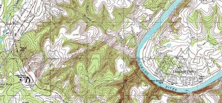
A topographic map shows the physical features of Earth. These features can be mountains, rivers, lakes, valleys, craters, and more. Man-made features such as roads may also be included.

In addition to physical features, a topographic map shows the elevation changes of land. Elevation is the height of land above a given level, usually sea level. Elevations are indicated with contour lines. Every point on the map connected to the same line is the same elevation. The lines have

Topography and Understanding Topographic Maps

usgs topographic map


Among the many mapping tools available, the most commonly used is the topographic map. Topography is defined as the relief (relative elevations) of a surface and the relative relations between its natural and man-made features. Topographic maps systematically portray the spatial relationship among both the physical features, such as contour lines (lines of equal elevation) and hydrographic symbols, and cultural features, such as roads and administrative boundaries. Topographic maps are also known as “topo maps.”


Reading a topographic map begins …