Aimee Mandeville – URI Environmental Data Center

aimee mandeville expert image


Aimée Mandeville is a Research Associate with the University of Rhode Island’s Environmental Data Center.  As a GIS Analyst in the EDC, she is involved in a variety of research projects utilizing geospatial technologies (GIS, GPS)  to perform analysis, generate maps and disseminate information through online mapping technologies.  She is a co-instructor and co-developer of technical hands-on training workshops offered through URI’s Geospatial Extension Training Program

Contact Information

email: aimee@edc.uri.edu

Patricia Moody Harveson – Sul Ross State University

Patricia Moody Harveson is an Associate Professor of Conservation Biology at Sul Ross State University and Research Scientist with the Borderlands Research Institute for Natural Resource Management.  She specializes in wildlife conservation and management.  Her specializations include GIS, GPS, population modeling, species distribution modeling, and carnivore ecology.  Patricia has a B.S. in Biology from Tarleton State University, an M.S. in Range and Wildlife Management from Texas A&M University-Kingsville, and a Ph.D. in Wildlife and Fisheries Sciences from Texas A&M …

Sharing Content in ArcGIS Online: Public and Organization Accounts


University of Rhode Island Environmental Center Screen Capture


Big Changes for ArcGIS Online 

ESRI has made two important changes to the ArcGIS Online platform: an account name change and a new account option.

  • Account name change: An ArcGIS Online account, once called a personal account, is now referred to as a public account
  • A new account option, referred to as an organization account, has been created. This account type requires a subscription to ArcGIS Online for Organizations. There is a cost associated with this account

Cary Chadwick – UConn Cooperative Extension

Cary Chadwick is the Geospatial Training Program coordinator at University of Connecticut’s Center for Land Use Education and Research (CLEAR), part of UConn Extension. As a geospatial educator, Cary’s role is to develop and offer hands-on technical training classes focused on the use of GIS, GPS and online mapping technology. Cary is also actively involved in a number of collaborative research projects at UConn that integrate geospatial technologies to better manage and understand natural resource systems.

Cary is a graduate …

Shane Bradt – UNH Cooperative Extension

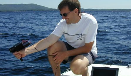
Shane Bradt taking reflectance measurements on a lake

Shane Bradt is a University of New Hampshire Cooperative Extension State Specialist with the UNHCE Natural Resources Program and an Extension Professor with the UNH Department of Biological Sciences. Shane’s programming focuses on geospatial technologies and aquatic resources (particularly lakes). Shane’s specializations including GIS, GPS, Remote Sensing, online mapping, mobile devices, lake ecology, watershed management and toxic cyanobacteria. Shane is the Content Manager for Map@Syst. He has a B.S. in Biology from Nazareth College of Rochester, and an …

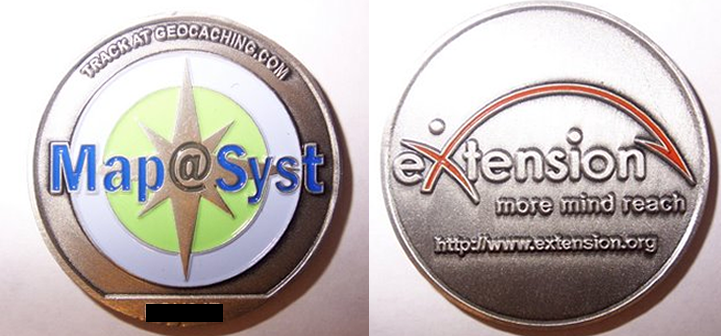
Map@Syst Geocoin

What is the Map@Syst Geocoin Adventure?

Map@Syst marketing campaign consists of participating in a world wide hide and seek adventure known as Geocaching. Geocaching is a recreational outlet for millions of people worldwide. Map@Syst chose to market eXtension in this manner because it reaches a large number of people and it also relates directly to our topic area of Geospatial Technology. Many people know what GPS, Geocaching, and Google Earth type things are, but they don’t particularly know that those …

Amy E. Hays – Texas AgriLife Extension

Amy Hays - Texas AgriLife Extension Service Bio Photo

Amy E. Hays is a Texas A&M AgriLife Extension Program Specialist with the Texas A&M Institute of Renewable Natural Resources.  She specializes in natural resource management.  Her specializations include GIS, GPS, Remote Sensing, distance education, social media, and community management (facilitation and leadership development).  She is currently serving on the eXtension Content Staff along with her duties for AgriLife.  Amy has a B.S. in Wildlife and Fisheries Sciences, and a M.S. in Rangeland Ecology and Management – both from …

Sharing GIS Data: Using an ESRI Map Package (.mpk)

You can use map packages to share map documents and associated data from ArcMap with other ArcMap users. A map package is created within ArcMap and contains the ArcMap document (.mxd) and all the data associated with that document. 

Learn about other ESRI software formats you can use to share data.


Exporting GIS Data as a Map Package from ArcMap for Use in ArcMap

To create the .mpk file: 

1.  Click File to display the drop-down menu, and then click …

Sharing GIS Data: Using an ESRI Published Map File (.pmf)

You can use published map files to share map documents and associated data from ArcMap with ArcReader users. A published map file is created within ArcMap, using the Publisher extension, and contains the map and all of the associated data. 

Learn about other ESRI software formats you can use to share data.


Exporting GIS Data as a Published Map File from ArcMap for Use in ArcReader

In ArcMap, you will need to activate the Publisher extension and then activate the …

Easy GIS Data and Map Collaboration Using ESRI Software

What is the most efficient way to collaborate on a project with users and nonusers of Esri’s software products, such as ArcGIS (ArcMap), ArcGIS Explorer Desktop (ArcExplorer), ArcGIS Online, and ArcReader?

You can use several approaches to package information (data and map) from a map created in ArcMap and share it with others – ArcMap users and non-ArcMap users alike.  

By using the file types listed in the tables below, you can allow collaborators to provide data accuracy or location …