Cary Chadwick – UConn Cooperative Extension

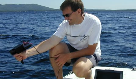
Cary Chadwick is the Geospatial Training Program coordinator at University of Connecticut’s Center for Land Use Education and Research (CLEAR), part of UConn Extension. As a geospatial educator, Cary’s role is to develop and offer hands-on technical training classes focused on the use of GIS, GPS and online mapping technology. Cary is also actively involved in a number of collaborative research projects at UConn that integrate geospatial technologies to better manage and understand natural resource systems.

Cary is a graduate …

Shane Bradt – UNH Cooperative Extension

Shane Bradt taking reflectance measurements on a lake

Shane Bradt is a University of New Hampshire Cooperative Extension State Specialist with the UNHCE Natural Resources Program and an Extension Professor with the UNH Department of Biological Sciences. Shane’s programming focuses on geospatial technologies and aquatic resources (particularly lakes). Shane’s specializations including GIS, GPS, Remote Sensing, online mapping, mobile devices, lake ecology, watershed management and toxic cyanobacteria. Shane is the Content Manager for Map@Syst. He has a B.S. in Biology from Nazareth College of Rochester, and an …

Amy E. Hays – Texas AgriLife Extension

Amy Hays - Texas AgriLife Extension Service Bio Photo

Amy E. Hays is a Texas A&M AgriLife Extension Program Specialist with the Texas A&M Institute of Renewable Natural Resources.  She specializes in natural resource management.  Her specializations include GIS, GPS, Remote Sensing, distance education, social media, and community management (facilitation and leadership development).  She is currently serving on the eXtension Content Staff along with her duties for AgriLife.  Amy has a B.S. in Wildlife and Fisheries Sciences, and a M.S. in Rangeland Ecology and Management – both from …